US Forestry Service Topo
Detailed, up-to-date topo maps covering all National Forests

Click to buy the USFS topo maps
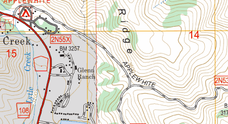
These are the official FS-Topo series maps from the United States Forest Service. Covering all National Forests in the Conterminous US, the up-to-date maps give all the detail of the classic USGS topo quads, showing buildings, trails and tracks that may not be shown on the modern USTopo product. In addition, they show Forest Service Road numbers, which are sometimes useful for finding your way in the backcountry. Inholdings in the forests are also clearly marked, though they may be subject to change.
Note, Alaska is not included in this set of maps.
Each National Forest is merged into a large seamless map.
The PC version allows you to plan your trip using our 3D terrain viewer, and print out paper maps to take with you. (When you are exploring away from civilization, we recommend that you don’t rely solely on your electronic gadgets, and a paper map and compass are a good idea).
We also have the classic USGS Topo 7.5′ Quads and USGS USTOPO maps covering the whole USA.
APP FEATURES:
- Moving map, lock GPS position anywhere on screen
- Record breadcrumb trail/track logs.
- Create and edit marks and routes.
- Import and export marks, routes and tracks in the open GPX format
- Display; Position, Average heading & speed, Compass heading, ETA, XTE, etc. The Navigation data window is user-configurable.
- Follow Route with range, bearing and time to next waypoint or end.
- Support for GPS, Compass and Barometric pressure sensors.
Bulk region download
You can bulk-download the maps for each National Forest separately. Use the “Download Whole Map” option in the app.